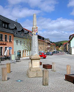
Bad Gottleuba-Berggießhübel
Bad Gottleuba-Berggießhübel är en stad i Landkreis Sächsische Schweiz-Osterzgebirge i förbundslandet Sachsen i Tyskland.[3] Staden har cirka 5 500 invånare.
| Bad Gottleuba-Berggießhübel | ||
| Stad | ||
Bad Gottleuba
| ||
|
||
| Land | ||
|---|---|---|
| Förbundsland | Sachsen | |
| Kreis | Landkreis Sächsische Schweiz-Osterzgebirge | |
| Förvaltningsgemenskap | Bad Gottleuba-Berggießhübel | |
| Höjdläge | 364 m ö.h. | |
| Koordinater | 50°51′30″N 13°57′0″Ö / 50.85833°N 13.95000°Ö | |
| Yta | 88,72 km² ()[1] | |
| Folkmängd | 5 541 ()[2] | |
| Befolkningstäthet | 62 inv./km² | |
| Postnummer | 01816 | |
| Riktnummer | (+49) 035023, 035025, 035032 och 035054 | |
| Registreringsskylt | PIR | |
| Kommunkod | 14 6 28 020 | |
| Geonames | 6550816 | |
| OSM-karta | 534518 | |
|
Bad Gottleuba-Berggießhübel i Tyskland
| ||
|
Läget för kommunen Bad Gottleuba-Berggießhübel i Landkreis Sächsische Schweiz-Osterzgebirge
| ||
| Webbplats: Bad Gottleuba-Berggießhübel | ||
Staden ingår i förvaltningsområdet Bad Gottleuba-Berggießhübel tillsammans med kommunerna Bahretal och Liebstadt.[3]

Källor
redigera- ^ Alle politisch selbständigen Gemeinden mit ausgewählten Merkmalen am 31.12.2018 (4. Quartal) (på tyska), Statistisches Bundesamt, läs online, läst: 10 mars 2019.[källa från Wikidata]
- ^ Alle politisch selbständigen Gemeinden mit ausgewählten Merkmalen am 31.12.2022, Statistisches Bundesamt, 21 september 2023, läs online, läst: 7 oktober 2023.[källa från Wikidata]
- ^ [a b] ”Alle politisch selbständigen Gemeinden mit ausgewählten Merkmalen am 31.03.2020” (Excel). Statistisches Bundesamt. 2020. https://www.destatis.de/DE/Themen/Laender-Regionen/Regionales/Gemeindeverzeichnis/Administrativ/Archiv/GVAuszugQ/AuszugGV1QAktuell.xlsx?__blob=publicationFile. Läst 10 maj 2020.


