Fil:Village Sign, Robertsbridge - geograph.org.uk - 1731097.jpg
Village_Sign,_Robertsbridge_-_geograph.org.uk_-_1731097.jpg (640 × 430 pixlar, filstorlek: 145 kbyte, MIME-typ: image/jpeg)
| Denna fil tillhandahålls av Wikimedia Commons. Informationen nedan är kopierad från dess filbeskrivningssida. |
Sammanfattning
| Beskrivning |
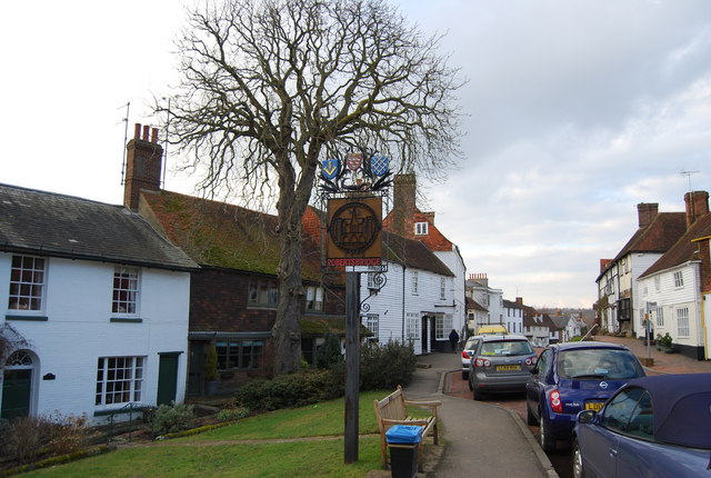
English: Village Sign, Robertsbridge Robertsbridge
Robertsbridge is a village in East Sussex, England within the civil parish of Salehurst and Robertsbridge. It is approximately ten miles (16 km) north of Hastings and thirteen miles (21 km) south-east of Tunbridge Wells. The River Rother passes through the village. The village is thought to date back to 1176 when a Cistercian abbey was founded there by the Abbot, Robert de St Martin. When a market charter was granted in 1198 by Richard I to 'Robertsbridge' (Pons Roberti in Latin) it was the first recorded use of the name. The abbey was dissolved in 1538; however, the town flourished, and many of the oldest existing houses in the village date from the 14th and 15th centuries, including The Seven Stars Inn on the historic High Street. Robertsbridge is also home to the Robertsbridge Codex (1360), a music manuscript of the 14th century. It contains the earliest surviving music written specifically for keyboard. Robertsbridge is well served by transport links with the Robertsbridge station on the main railway line from Hastings to London and the A21 trunk road, although the latter has problems with transport delays. The opening of the Robertsbridge bypass, in 1989, relieved the village of constant traffic through it. Robertsbridge Community College, a specialist Mathematics and Computer college, is the smallest such in the county of East Sussex. Also, as well as the secondary school in the village, there is a primary school (Salehurst Church of England Primary), a school with an exceedingly good reputation throughout the area. Among sports clubs is the Robertsbridge Rugby Football Club. |
| Datum | |
| Källa | From geograph.org.uk |
| Skapare | Nigel Chadwick |
| Kameraposition | | Se denna och andra närliggande bilder på: OpenStreetMap |
|---|
_heading:0.00&language=sv)
| Objektposition | | Se denna och andra närliggande bilder på: OpenStreetMap |
|---|
_heading:0.00&language=sv)
Licensiering

|
Denna bild togs från samlingen Geograph project. Se sidan till detta fotografi på Geographs webbplats för fotografens kontaktinformation. Upphovsrätten på denna sida ägs av Nigel Chadwick och är licenserad för återanvändning under licensen Creative Commons Attribution-DelaLika 2.0.
|
- Du är fri:
- att dela – att kopiera, distribuera och sända verket
- att remixa – att skapa bearbetningar
- På följande villkor:
- erkännande – Du måste ge lämpligt erkännande, ange en länk till licensen och indikera om ändringar har gjorts. Du får göra det på ett lämpligt sätt, men inte på ett sätt som antyder att licensgivaren stödjer dig eller din användning.
- dela lika – Om du remixar, transformerar eller bygger vidare på materialet måste du distribuera dina bidrag under samma eller en kompatibel licens som originalet.
Filhistorik
Klicka på ett datum/klockslag för att se filen som den såg ut då.
| Datum/Tid | Miniatyrbild | Dimensioner | Användare | Kommentar | |
|---|---|---|---|---|---|
| nuvarande | 5 mars 2011 kl. 19.07 | | 640 × 430 (145 kbyte) | GeographBot | == {{int:filedesc}} == {{Information |description={{en|1=Village Sign, Robertsbridge Robertsbridge Robertsbridge is a village in East Sussex, England within the civil parish of Salehurst and Robertsbridge. It is approximately ten miles (16 km) north of H |
Filanvändning
Följande sida använder den här filen:
Global filanvändning
Följande andra wikier använder denna fil:
- Användande på ceb.wikipedia.org
- Användande på en.wikipedia.org
- Användande på fr.wikipedia.org
- Användande på nl.wikipedia.org
- Användande på www.wikidata.org