Fil:USACE Mansfield Hollow Lake.jpg
Storlek på förhandsvisningen: 748 × 600 pixlar. Andra upplösningar: 299 × 240 pixlar | 599 × 480 pixlar | 958 × 768 pixlar | 1 277 × 1 024 pixlar | 1 500 × 1 203 pixlar.
Originalfil (1 500 × 1 203 pixlar, filstorlek: 1,53 Mbyte, MIME-typ: image/jpeg)
| Denna fil tillhandahålls av Wikimedia Commons. Informationen nedan är kopierad från dess filbeskrivningssida. |
|
This is an image of a place or building that is listed on the National Register of Historic Places in the United States of America. Its reference number is 3000194. |
| Beskrivning |
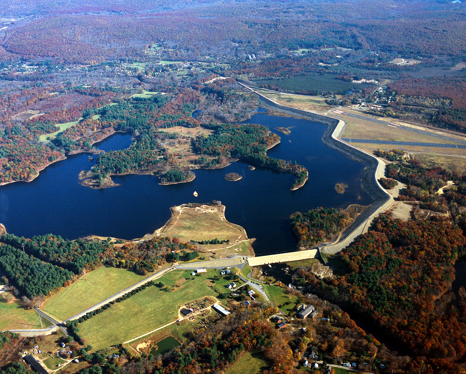
English: Mansfield Hollow Lake in Tolland County, Mansfield, Connecticut, USA. The U.S. Army Corps of Engineers constructed the dam as a flood control measure. It impounds the waters of the Fenton, Mount Hope, and Natchaug Rivers. |
|||
| Datum | 10 april 1999 (Date as given in the description, but the date seems unlikely given the autumn color in the landscape.) | |||
| Källa |
U.S. Army Corps of Engineers Digital Visual Library Image page Image description page Digital Visual Library home page |
|||
| Skapare | U.S. Army Corps of Engineers, photographer not specified or unknown | |||
| Tillstånd (Återanvändning av denna fil) |
|
| Kameraposition | | Se denna och andra närliggande bilder på: OpenStreetMap |
|---|
Filhistorik
Klicka på ett datum/klockslag för att se filen som den såg ut då.
| Datum/Tid | Miniatyrbild | Dimensioner | Användare | Kommentar | |
|---|---|---|---|---|---|
| nuvarande | 4 juni 2007 kl. 07.04 | | 1 500 × 1 203 (1,53 Mbyte) | Grendelkhan | {{Information | Description = {{en|Mansfield Hollow Lake in Windham County, Connecticut, USA. The U.S. Army Corps of Engineers constructed the dam as a flood control measure. It impounds the waters of the Natchaug River.}} | Source = U.S. Army |
Filanvändning
Följande sida använder den här filen:
Global filanvändning
Följande andra wikier använder denna fil:
- Användande på ceb.wikipedia.org
- Användande på de.wikipedia.org
- Användande på en.wikipedia.org
- Mansfield, Connecticut
- List of Connecticut state parks
- National Register of Historic Places listings in Tolland County, Connecticut
- National Register of Historic Places listings in Windham County, Connecticut
- Mansfield Hollow Lake
- Portal:Geography/Featured picture/2007, week 40
- Portal:Geography/Featured picture archive/2007
- Wikipedia:WikiProject Lakes/Galleries/11
- Mansfield Hollow State Park
- Användande på fa.wikipedia.org
- Användande på pl.wikipedia.org
- Användande på www.wikidata.org