Fil:Oslo Areas and barrier projection 2005.png
Originalfil (3 789 × 7 221 pixlar, filstorlek: 268 kbyte, MIME-typ: image/png)
| Denna fil tillhandahålls av Wikimedia Commons. Informationen nedan är kopierad från dess filbeskrivningssida. |
Sammanfattning
| Beskrivning |
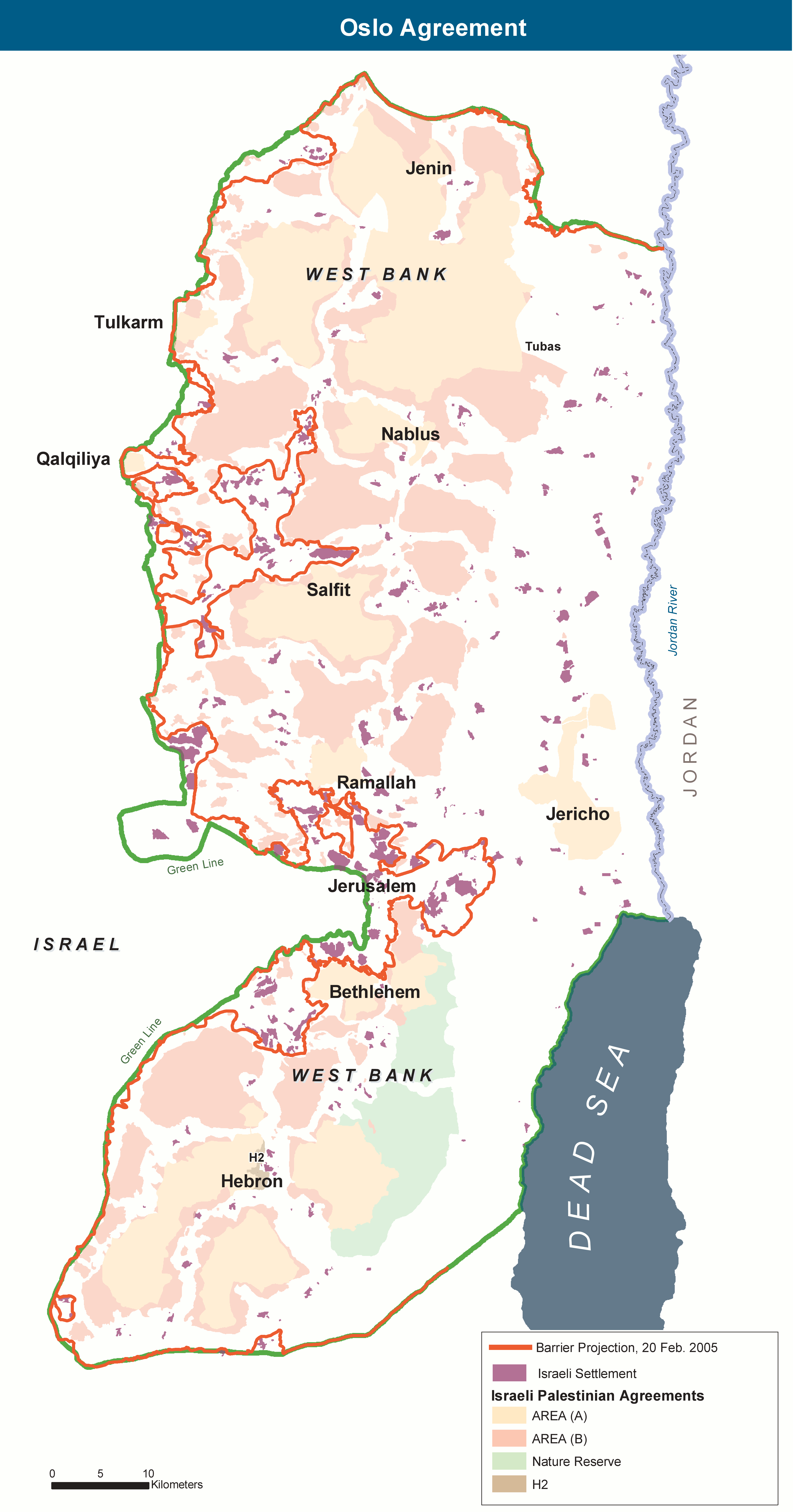
English: The Areas of the West Bank, created by the Oslo II Accord of 1995, and the Israeli Wall project as of 20 February 2005. |
| Datum | |
| Källa | Eget arbete. Adaptation of http://www.ochaopt.org/documents/WB_OsloGov&Barrier_July05.pdf on OCHAoPt Map Centre. |
| Skapare | Wickey-nl |
Licensiering
| This image is a map derived from a United Nations map.
Unless stated otherwise, UN maps are to be considered in the public domain. This applies worldwide. UN maps are, in principle, open source material and you can use them in your work or for making your own map. UN requests however that you delete the UN name, logo and reference number upon any modification to the map. Content of your map will be your responsibility. You can state in your publication, if you wish, something like: based on UN map … (map name, map number, revision number and date). See: Geospatial Information Section. And: Geospatial, location data for a better world. |
 |
Filhistorik
Klicka på ett datum/klockslag för att se filen som den såg ut då.
| Datum/Tid | Miniatyrbild | Dimensioner | Användare | Kommentar | |
|---|---|---|---|---|---|
| nuvarande | 7 november 2013 kl. 14.01 | | 3 789 × 7 221 (268 kbyte) | Wickey-nl | User created page with UploadWizard |
Filanvändning
Följande sida använder den här filen:
Global filanvändning
Följande andra wikier använder denna fil:
- Användande på ar.wikipedia.org
- Användande på ca.wikipedia.org
- Användande på de.wikipedia.org
- Användande på en.wikipedia.org
- Användande på es.wikipedia.org
- Användande på eu.wikipedia.org
- Användande på fr.wikipedia.org
- Användande på he.wikipedia.org
- Användande på it.wikipedia.org
- Användande på ko.wikipedia.org
- Användande på pl.wikipedia.org
- Användande på sh.wikipedia.org
- Användande på www.wikidata.org
- Användande på zh-yue.wikipedia.org