Fil:Nicaragua pol 97.jpg

Storlek på förhandsvisningen: 600 × 600 pixlar. Andra upplösningar: 240 × 240 pixlar | 480 × 480 pixlar | 968 × 968 pixlar.
Originalfil (968 × 968 pixlar, filstorlek: 227 kbyte, MIME-typ: image/jpeg)
| Denna fil tillhandahålls av Wikimedia Commons. Informationen nedan är kopierad från dess filbeskrivningssida. |
Sammanfattning
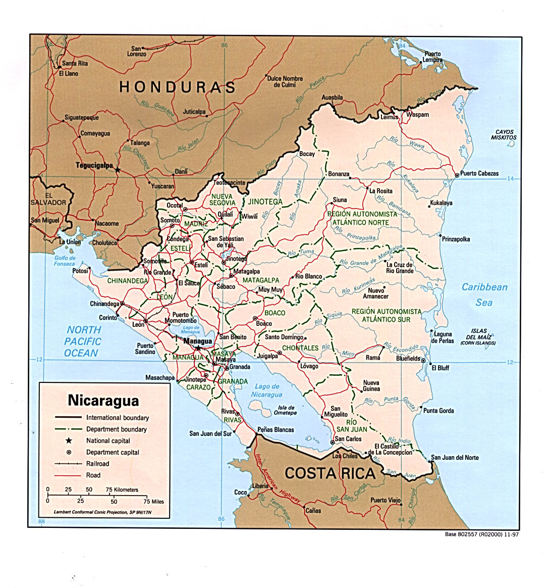
| Beskrivning | Political map of Nicaragua |
| Datum | |
| Källa | http://www.lib.utexas.edu/maps/americas/nicaragua_pol_97.jpg (see http://www.lib.utexas.edu/maps/nicaragua.html for attribution) |
| Skapare | U.S. Central Intelligence Agency |
| Tillstånd (Återanvändning av denna fil) |
public domain |
Licensiering
| This image is a work of a Central Intelligence Agency employee, taken or made as part of that person's official duties. As a Work of the United States Government, this image or media is in the public domain in the United States.
|

|
Filhistorik
Klicka på ett datum/klockslag för att se filen som den såg ut då.
| Datum/Tid | Miniatyrbild | Dimensioner | Användare | Kommentar | |
|---|---|---|---|---|---|
| nuvarande | 17 maj 2006 kl. 21.08 | | 968 × 968 (227 kbyte) | Mahagaja | {{Information| |Description=Political map of Nicaragua |Source=http://www.lib.utexas.edu/maps/americas/nicaragua_pol_97.jpg (see http://www.lib.utexas.edu/maps/nicaragua.html for attribution) |Date=1997 |Author=U.S. Central Intelligence Agency |Permis |
Filanvändning
Följande sida använder den här filen:
Global filanvändning
Följande andra wikier använder denna fil:
- Användande på ar.wikipedia.org
- Användande på de.wikipedia.org
- Användande på en.wikipedia.org
- Användande på es.wikipedia.org
- Användande på fr.wikipedia.org
- Användande på it.wikipedia.org
- Användande på pam.wikipedia.org
- Användande på pt.wikipedia.org
- Användande på sl.wikipedia.org
- Användande på uk.wikipedia.org
- Användande på zh.wikipedia.org