Fil:NSW in Australia map.png
Det finns ingen version med högre upplösning.
NSW_in_Australia_map.png (200 × 186 pixlar, filstorlek: 11 kbyte, MIME-typ: image/png)
| Denna fil tillhandahålls av Wikimedia Commons. Informationen nedan är kopierad från dess filbeskrivningssida. |

|
Det finns en vektorversion av denna rasterbild (SVG).
När vektorbilden är lämpligare ska den användas istället för rasterbilden. File:NSW in Australia map.png → File:New South Wales in Australia.svg
För mer information om vektorgrafik, se artikeln Commons transition to SVG (på engelska). |
 |
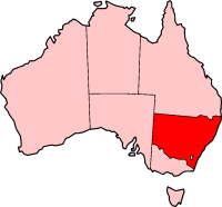
New South Wales location - (from en.wikipedia.org)

|
Tillstånd ges att kopiera, distribuera och/eller modifiera detta dokument under villkoren i GNU Free Documentation License, Version 1.2 eller senare version publicerad av Free Software Foundation, utan oföränderliga avsnitt, framsidestexter eller baksidestexter. En kopia av licensen ingår i avsnittet GNU Free Documentation License. |
| Denna fil har gjorts tillgänglig under licensen Creative Commons Erkännande-Dela Lika 3.0 Generisk | ||
| ||
| Detta licenstillägg lades till till denna fil som en del av GFDL:s licensuppdatering. |
Filhistorik
Klicka på ett datum/klockslag för att se filen som den såg ut då.
| Datum/Tid | Miniatyrbild | Dimensioner | Användare | Kommentar | |
|---|---|---|---|---|---|
| nuvarande | 27 november 2004 kl. 05.24 | | 200 × 186 (11 kbyte) | Jeroen | New South Wales location - (from en.wikipedia.org) |
Filanvändning
Inga sidor använder den här filen.
Global filanvändning
Följande andra wikier använder denna fil:
- Användande på de.wikipedia.org
- Användande på en.wikipedia.org
- Ghin-Doo-Ee National Park
- Goulburn River National Park
- Mount Royal National Park
- Towarri National Park
- Wallingat National Park
- Watagans National Park
- See Change Festival
- Swansea, New South Wales
- Australian south-east coast drainage division
- Come By Chance, New South Wales
- Lake Burrendong
- Highways in New South Wales
- Bonshaw, New South Wales
- Shellharbour, New South Wales
- Goolmangar, New South Wales
- Pilliga, New South Wales
- Tooraweenah
- Woodenbong
- Exeter, New South Wales
- Western Division (New South Wales)
- Tarana, New South Wales
- City of Queanbeyan
- Medlow Bath, New South Wales
- Lake Victoria (New South Wales)
- Wilsons Peak
- Belford, New South Wales
- Mount Hutton, New South Wales
- Clunes, New South Wales
- Goonellabah, New South Wales
- Muster (census)
- Southern Tablelands
- Mount Pleasant, New South Wales
- Narrabri Stellar Intensity Interferometer
- Valla, New South Wales
- Terry Hie Hie, New South Wales
- Milson Island
- Tallimba
- Perrys Lookdown
- Evans Lookout
- Nepean Gorge
- Shark Island (Cronulla Beach)
- Linden, New South Wales
- Capital Country
- Mororo, New South Wales
- Wonboyn Lake
- Horsley, New South Wales
- Cullen Bullen, New South Wales
- Pigeon House Mountain
Visa mer globalt användande av denna fil.