Fil:NASA Mando-Koresand.png
Storlek på förhandsvisningen: 612 × 599 pixlar. Andra upplösningar: 245 × 240 pixlar | 620 × 607 pixlar.
Originalfil (620 × 607 pixlar, filstorlek: 962 kbyte, MIME-typ: image/png)
| Denna fil tillhandahålls av Wikimedia Commons. Informationen nedan är kopierad från dess filbeskrivningssida. |
Sammanfattning
| Beskrivning |
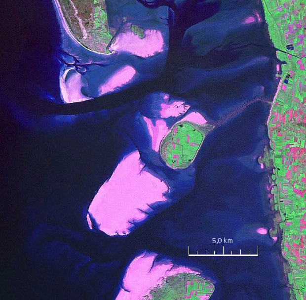
English: Mandø, the Danish Wadden Island, with Koresand close southwest, Fanø to the north, Romø to the south and the Jutland mainland coast to the east |
| Datum | |
| Källa | NASA World Wind Screen Shot |
| Skapare | NASA |
Licensiering
| This image is in the public domain because it is a screenshot from NASA’s globe software World Wind using a public domain layer, such as Blue Marble, MODIS, Landsat, SRTM, USGS or GLOBE.
|
 |
| Annotations | This image is annotated: View the annotations at Commons |
Filhistorik
Klicka på ett datum/klockslag för att se filen som den såg ut då.
| Datum/Tid | Miniatyrbild | Dimensioner | Användare | Kommentar | |
|---|---|---|---|---|---|
| nuvarande | 19 augusti 2009 kl. 19.57 | | 620 × 607 (962 kbyte) | Ratzer | {{Information |Description={{en|1=Mandø, the Danish Wadden Island, with Koresand close southwest, Fanø to the north, Romø to the south and the Jutland mainland coast to the east}} |Source=NASA World Wind Screen Shot |Author=NASA |Date=2000 |Permission= |
Filanvändning
Följande 4 sidor använder den här filen:
Global filanvändning
Följande andra wikier använder denna fil:
- Användande på da.wikipedia.org
- Användande på de.wikipedia.org
- Användande på frr.wikipedia.org
- Användande på fr.wikipedia.org
- Användande på fy.wikipedia.org
- Användande på hu.wikipedia.org
- Användande på no.wikipedia.org