Fil:Leland Michigan aerial view.jpg

Storlek på förhandsvisningen: 800 × 562 pixlar. Andra upplösningar: 320 × 225 pixlar | 640 × 449 pixlar | 1 024 × 719 pixlar | 1 280 × 899 pixlar | 1 500 × 1 053 pixlar.
Originalfil (1 500 × 1 053 pixlar, filstorlek: 626 kbyte, MIME-typ: image/jpeg)
| Denna fil tillhandahålls av Wikimedia Commons. Informationen nedan är kopierad från dess filbeskrivningssida. |
| Beskrivning |
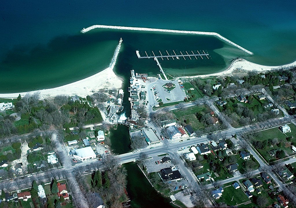
English: Aerial view of the shore and breakwater on Lake Michigan at Leland, Michigan, USA. The U.S. Army Corps of Engineers constructed the harbor and breakwater at the town. |
|||
| Datum | not specified or unknown | |||
| Källa |
U.S. Army Corps of Engineers Digital Visual Library Image page Image description page Digital Visual Library home page |
|||
| Skapare | U.S. Army Corps of Engineers, photographer not specified or unknown | |||
| Tillstånd (Återanvändning av denna fil) |
|
|||
| Plats | Leland, Leelanau County, Michigan, USA |
| Kameraposition | | Se denna och andra närliggande bilder på: OpenStreetMap |
|---|
Filhistorik
Klicka på ett datum/klockslag för att se filen som den såg ut då.
| Datum/Tid | Miniatyrbild | Dimensioner | Användare | Kommentar | |
|---|---|---|---|---|---|
| nuvarande | 30 mars 2007 kl. 01.58 | | 1 500 × 1 053 (626 kbyte) | DanMS | {{Information | Description = {{en|Aerial view of the shore and breakwater on Lake Michigan at Leland, Michigan, USA. The U.S. Army Corps of Engineers constructed the harbor and breakwater at the town.}} | Source = U.S. Army Corps of Engineers |
Filanvändning
Följande sida använder den här filen:
Global filanvändning
Följande andra wikier använder denna fil:
- Användande på azb.wikipedia.org
- Användande på ceb.wikipedia.org
- Användande på cy.wikipedia.org
- Användande på en.wikipedia.org
- Användande på en.wikivoyage.org
- Användande på es.wikipedia.org
- Användande på fa.wikipedia.org
- Användande på fr.wikipedia.org
- Användande på lld.wikipedia.org
- Användande på pl.wikipedia.org
- Användande på ro.wikipedia.org
- Användande på sh.wikipedia.org
- Användande på sr.wikipedia.org
- Användande på tt.wikipedia.org
- Användande på uk.wikipedia.org
- Användande på www.wikidata.org