Originalfil(9 356 × 9 836 pixlar, filstorlek: 12,49 Mbyte, MIME-typ: image/jpeg)

Varning En del webbläsare kan ha problem med att visa denna bild i full upplösning: Denna bild har ett stort antal bildpunkter (pixlar) och kan antingen inte läsas in ordentligt eller få din webbläsare att låsa sig.

Coordinates of map center

Beskrivning
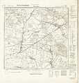
Polski: Niemiecka mapa topograficzna Messtischblatt nr 4771 (Stradomia Wierzchnia) z 1938 r. Skala 1:25000.
Svenska: Bilden / kartan finns publicerad på internet: http://www.amzp.pl/maps.shtml Bilden är en karta publicerad 1887 av Preussiska Landesaufnahme.
Deutsch: Preussische Landesaufnahme 1887, korrigiert durch Reichsamt für Landesaufnahme 1928, Stand 1936
Datum
Källa http://igrek.amzp.pl/5679
http://amzpbig.com/maps/4771_Stradam_bn_1938.jpg
Skapare AnonymUnknown author
Tillstånd
(Återanvändning av denna fil)
Public domain
This image (or other media file) is in the public domain because its copyright has expired and its author is anonymous.
This applies to the European Union and those countries with a copyright term of 70 years after the work was made available to the public and the author never disclosed their identity.
Important: Always mention where the image comes from, as far as possible, and make sure the author never claimed authorship.
Flag of Europe
Flag of Europe
Warning sign
Warning sign
Note: In Germany and possibly other countries, certain anonymous works published before July 1, 1995 are copyrighted until 70 years after the death of the author. See Übergangsrecht. Please use this template only if the author never claimed authorship or their authorship never became public in any other way. If the work is anonymous or pseudonymous (e.g., published only under a corporate or organization's name), use this template for images published more than 70 years ago. For a work made available to the public in the United Kingdom, please use Template:PD-UK-unknown instead.

Bildtexter

Ingen bildtext har definierats

Objekt som porträtteras i den här filen

motiv

Filhistorik

Klicka på ett datum/klockslag för att se filen som den såg ut då.

Datum/TidMiniatyrbildDimensionerAnvändareKommentar
nuvarande11 oktober 2009 kl. 18.12Miniatyrbild för versionen från den 11 oktober 2009 kl. 18.129 356 × 9 836 (12,49 Mbyte)Hbsggo~commonswiki{{Information |Description={{sv|1=Bilden / kartan finns publicerad på internet: http.//www.amzp.pl/maps.shtml }} |Source=Bilden finns utlagd på internet; http://mapy.amzp.pl/maps.shtml |Author=http://mapy.amzp.pl/maps.shtml |Date=1887 |Permission= |othe

Följande sida använder den här filen:

Metadata