Fil:Herefordshire UK locator map 2010.svg

Storleken för denna PNG-förhandsvisning av denna SVG-fil: 494 × 600 pixlar. Andra upplösningar: 198 × 240 pixlar | 395 × 480 pixlar | 633 × 768 pixlar | 843 × 1 024 pixlar | 1 687 × 2 048 pixlar | 1 108 × 1 345 pixlar.
Originalfil (SVG-fil, standardstorlek: 1 108 × 1 345 pixlar, filstorlek: 302 kbyte)
| Denna fil tillhandahålls av Wikimedia Commons. Informationen nedan är kopierad från dess filbeskrivningssida. |
Sammanfattning
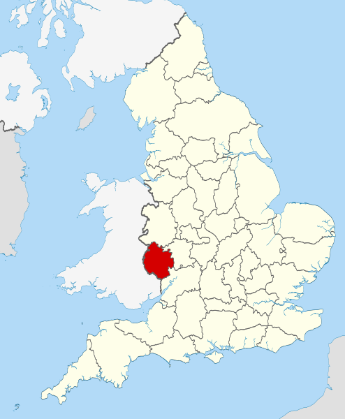
| Beskrivning | Location of the ceremonial county of Herefordshire within England. |
| Datum | |
| Källa |
National Geospatial-Intelligence Agency
|
| Skapare | Nilfanion |
Licensiering
Jag, upphovsrättsinnehavaren av detta verk, publicerar härmed det under följande licenser:
Denna fil har gjorts tillgänglig under licensen Creative Commons Erkännande-Dela Lika 3.0 Unported
- Du är fri:
- att dela – att kopiera, distribuera och sända verket
- att remixa – att skapa bearbetningar
- På följande villkor:
- erkännande – Du måste ge lämpligt erkännande, ange en länk till licensen och indikera om ändringar har gjorts. Du får göra det på ett lämpligt sätt, men inte på ett sätt som antyder att licensgivaren stödjer dig eller din användning.
- dela lika – Om du remixar, transformerar eller bygger vidare på materialet måste du distribuera dina bidrag under samma eller en kompatibel licens som originalet.

|
Tillstånd ges att kopiera, distribuera och/eller modifiera detta dokument under villkoren i GNU Free Documentation License, Version 1.2 eller senare version publicerad av Free Software Foundation, utan oföränderliga avsnitt, framsidestexter eller baksidestexter. En kopia av licensen ingår i avsnittet GNU Free Documentation License. |
Du får själv välja den licens du vill använda.

|
This is one of the images forming part of the Valued image set: Locator maps of the Ceremonial counties of England on Wikimedia Commons. The image set has been assessed under the valued image set criteria and is considered the most valued set on Commons within the scope:
Locator maps of the Ceremonial counties of England
You can see its nomination at Commons:Valued image candidates/Locator maps of English ceremonial counties. |
Filhistorik
Klicka på ett datum/klockslag för att se filen som den såg ut då.
| Datum/Tid | Miniatyrbild | Dimensioner | Användare | Kommentar | |
|---|---|---|---|---|---|
| nuvarande | 24 november 2010 kl. 00.38 | | 1 108 × 1 345 (302 kbyte) | Nilfanion | == Summary == {{Information |Description=Location of the ceremonial county of Herefordshire within England. |Source=Ordnance Survey [https://www.ordnancesurvey.co.uk/opendatadownload/products.html OpenData]: *Coun |
Filanvändning
Följande 2 sidor använder den här filen:
Global filanvändning
Följande andra wikier använder denna fil:
- Användande på af.wikipedia.org
- Användande på ar.wikipedia.org
- Användande på ast.wikipedia.org
- Användande på be-tarask.wikipedia.org
- Användande på bg.wikipedia.org
- Användande på br.wikipedia.org
- Användande på ca.wikipedia.org
- Användande på ceb.wikipedia.org
- Användande på cs.wikipedia.org
- Användande på dag.wikipedia.org
- Användande på en.wikipedia.org
- Dore Abbey
- Eye, Herefordshire
- Blackwardine
- Edvin Loach
- Herefordshire
- Hereford Cathedral
- Whitchurch, Herefordshire
- Combe, Herefordshire
- Much Dewchurch
- Thornbury, Herefordshire
- Grandmontines
- Hoarwithy, Herefordshire
- Abbey Dore
- Weston Beggard
- Aconbury
- Acton Beauchamp
- Acton Green, Herefordshire
- Birtley, Herefordshire
- Blakemere
- Yazor
- Little Hereford
- Preston on Wye
- Allensmore
- Ashperton
- Aymestrey
- Ballingham
- Bartestree
- Bishop's Frome
- Stoke Prior, Herefordshire
- Yarkhill
- Woolhope
- Wolferlow
- Whitney-on-Wye
- Belmont Rural
- Pipe and Lyde
- Haywood, Herefordshire
- Grafton, Herefordshire
Visa mer globalt användande av denna fil.