Fil:Hanstholmen-map.png

Originalfil (2 260 × 1 557 pixlar, filstorlek: 1,14 Mbyte, MIME-typ: image/png)
| Denna fil tillhandahålls av Wikimedia Commons. Informationen nedan är kopierad från dess filbeskrivningssida. |
Sammanfattning
Source: http://en.wikipedia.org/wiki/Image:Hanstholmen-map.png
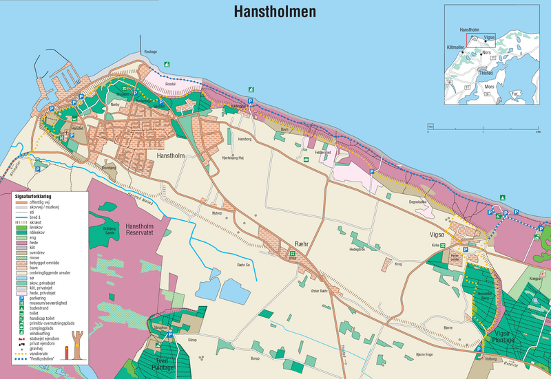
A detailed map of Hanstholm. From the brochure "Vandreture nr. 118. Hanstholmen", updated January 2005, published by the Danish Forest and Nature Agency. The dashed lines indicate a very steep slope, the former coastline.
Licensiering
Under the case number "J.nr. SN 2001-0650-0003", where Lars Dybdahl requested permission to use this map with Wikipedia, the case was handled by the responsible person Pia Bøttiger Andersen from the Danish Ministry of the Environment, on the date 2005-12-20. The response was, that the Danish Forest and Nature Agency has permitted the use of this map for general use, as long as a reference to the source is given. This is an example of such a reference is in Danish:
- Fra Skov- og Naturstyrelsens folder "Vandreture nr. 118. Hanstholmen (opdateret januar 2005).
This translates into:
- From the Danish Forest and Nature Agency brochure "Vandreture nr. 118. Hanstholmen" (updated January 2005)
The official homepage of the agency is: www.skovognatur.dk Official email address of the agency is: sns@sns.dk
- Du är fri:
- att dela – att kopiera, distribuera och sända verket
- att remixa – att skapa bearbetningar
- På följande villkor:
- erkännande – Du måste ge lämpligt erkännande, ange en länk till licensen och indikera om ändringar har gjorts. Du får göra det på ett lämpligt sätt, men inte på ett sätt som antyder att licensgivaren stödjer dig eller din användning.
- dela lika – Om du remixar, transformerar eller bygger vidare på materialet måste du distribuera dina bidrag under samma eller en kompatibel licens som originalet.
Filhistorik
Klicka på ett datum/klockslag för att se filen som den såg ut då.
| Datum/Tid | Miniatyrbild | Dimensioner | Användare | Kommentar | |
|---|---|---|---|---|---|
| nuvarande | 27 juni 2006 kl. 19.45 | | 2 260 × 1 557 (1,14 Mbyte) | Igiveup | == Summary == Source: http://en.wikipedia.org/wiki/Image:Hanstholmen-map.png A detailed map of Hanstholm. From the brochure "Vandreture nr. 118. Hanstholmen", updated January 2005, published by [http://www.sns.dk/ the Danish Forest and Nature Agency]. T |
Filanvändning
Följande sida använder den här filen:
Global filanvändning
Följande andra wikier använder denna fil: