Fil:Habsburg Monarchy 1789.svg

Storleken för denna PNG-förhandsvisning av denna SVG-fil: 450 × 456 pixlar. Andra upplösningar: 237 × 240 pixlar | 474 × 480 pixlar | 758 × 768 pixlar | 1 011 × 1 024 pixlar | 2 021 × 2 048 pixlar.
Originalfil (SVG-fil, standardstorlek: 450 × 456 pixlar, filstorlek: 857 kbyte)
| Denna fil tillhandahålls av Wikimedia Commons. Informationen nedan är kopierad från dess filbeskrivningssida. |
Sammanfattning


.svg)
.svg)
.svg)
.svg)
.svg)


.svg)
.svg)
.svg)


.png)
.png)


.svg)


.svg)

.svg)


.svg)
.svg)
.svg)
.svg)


.svg)
.png)


.svg)


.svg)
.svg)


.svg)


.svg)


.svg)
.svg)
.svg)
.svg)
.svg)
.svg)
.svg)
_cropped.svg)
.svg)
.svg)
.svg)
.svg)
.svg)
.svg)
.svg)
.svg)
.svg)
.svg)
.svg)
.svg)
.svg)
.svg)
.svg)
.svg)
.svg)
.svg)
.svg)
.svg)
.svg)
.svg)
.svg)
.svg)
.svg)
.svg)
.svg)
.svg)
.svg)
.svg)
.svg)
.svg)
.svg)
.svg)
.svg)
.svg)
.svg)
.svg)
.svg)
.svg)
.svg)
.svg)
.svg)
.svg)
.svg)
Licensiering
Jag, upphovsrättsinnehavaren av detta verk, publicerar härmed det under följande licens:
Denna fil har gjorts tillgänglig under licensen Creative Commons Erkännande-Dela Lika 3.0 Generisk
- Du är fri:
- att dela – att kopiera, distribuera och sända verket
- att remixa – att skapa bearbetningar
- På följande villkor:
- erkännande – Du måste ge lämpligt erkännande, ange en länk till licensen och indikera om ändringar har gjorts. Du får göra det på ett lämpligt sätt, men inte på ett sätt som antyder att licensgivaren stödjer dig eller din användning.
- dela lika – Om du remixar, transformerar eller bygger vidare på materialet måste du distribuera dina bidrag under samma eller en kompatibel licens som originalet.
Ursprunglig uppladdningslogg
This image is a derivative work of the following images:
- File:Europe_1789.svg licensed with Cc-by-sa-3.0
- 2013-04-14T01:38:01Z Alphathon 450x456 (853881 Bytes) tweaked again
- 2013-04-14T01:36:10Z Alphathon 450x456 (853881 Bytes) Tweaked Holy Roman Empire border style
- 2013-04-14T01:33:26Z Alphathon 450x456 (853857 Bytes) == {{int:filedesc}} == {{Information |Description={{en|A blank Map of Europe circa 1789. This map also includes a border for the [[:en:Holy Roman Empire|Holy Roman Empire]]. Since there are so many small German states, they h
Uploaded with derivativeFX
Filhistorik
Klicka på ett datum/klockslag för att se filen som den såg ut då.
| Datum/Tid | Miniatyrbild | Dimensioner | Användare | Kommentar | |
|---|---|---|---|---|---|
| nuvarande | 17 oktober 2021 kl. 09.54 | | 450 × 456 (857 kbyte) | Fenn-O-maniC | Fixed the Russo-Swedish border to match the Treaty of Åbo of 1743 |
| 18 april 2013 kl. 22.27 |  | 450 × 456 (877 kbyte) | Alphathon | Style changes | |
| 18 april 2013 kl. 19.22 |  | 450 × 456 (856 kbyte) | Alphathon | HRE border | |
| 18 april 2013 kl. 19.19 |  | 450 × 456 (820 kbyte) | Alphathon | Various fixes | |
| 18 april 2013 kl. 16.48 |  | 450 × 456 (853 kbyte) | Alphathon | Fixed Scandinavian borders | |
| 14 april 2013 kl. 05.47 |  | 450 × 456 (839 kbyte) | Alphathon | As main version | |
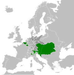
| 14 april 2013 kl. 03.59 |  | 450 × 456 (831 kbyte) | Alphathon | == {{int:filedesc}} == {{Information |Description={{en|A map of the Habsburg Monarchy circa 1789.}}{{de|Eine Landkarte die Habsburgermonarchie, c. 1989.}} |Source={{Derived from|Europe_1789.svg|disp... |
Filanvändning
Följande sida använder den här filen:
Global filanvändning
Följande andra wikier använder denna fil:
- Användande på cs.wikipedia.org
- Användande på de.wikipedia.org
- Användande på en.wikipedia.org
- Användande på es.wikipedia.org
- Användande på fr.wikipedia.org
- Användande på it.wikipedia.org
- Användande på lt.wikipedia.org
- Användande på pl.wikipedia.org
- Användande på sr.wikipedia.org