Fil:Grand Comore (Comoros) map.jpg

Storlek på förhandsvisningen: 294 × 599 pixlar. Andra upplösningar: 118 × 240 pixlar | 402 × 819 pixlar.
Originalfil (402 × 819 pixlar, filstorlek: 39 kbyte, MIME-typ: image/jpeg)
| Denna fil tillhandahålls av Wikimedia Commons. Informationen nedan är kopierad från dess filbeskrivningssida. |
Sammanfattning
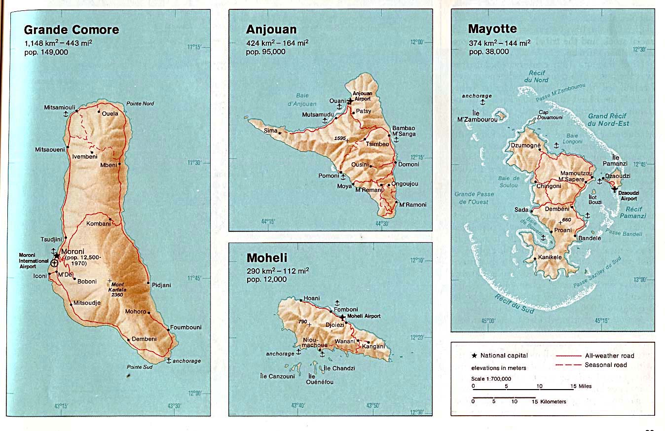
| Beskrivning | Grand Comore. From The Indian Ocean Atlas, CIA, 1976. |
| Datum | |
| Källa | University of Texas Libraries, Perry-Castañeda Library Map Collection: Comoros Maps (extracted) |
| Skapare | CIA |
| Andra versioner |

_map.jpg)
_map.jpg&action=edit&redlink=1)
_map.jpg)
Licensiering
| This image is a work of a Central Intelligence Agency employee, taken or made as part of that person's official duties. As a Work of the United States Government, this image or media is in the public domain in the United States.
|

|
Filhistorik
Klicka på ett datum/klockslag för att se filen som den såg ut då.
| Datum/Tid | Miniatyrbild | Dimensioner | Användare | Kommentar | |
|---|---|---|---|---|---|
| nuvarande | 8 september 2007 kl. 06.30 | | 402 × 819 (39 kbyte) | BetacommandBot | Transwiki approved by: w:en:User:Dmcdevit This image was copied from wikipedia:en. The original description was: == Summary == Detailed map of Anjouan(Comoros), from http://www.lib.utexas.edu/maps/africa.html, touched up heavily. == Licensing == {{ |
Filanvändning
Följande sida använder den här filen:
Global filanvändning
Följande andra wikier använder denna fil:
- Användande på ar.wikipedia.org
- Användande på fr.wikipedia.org
_map.jpg)