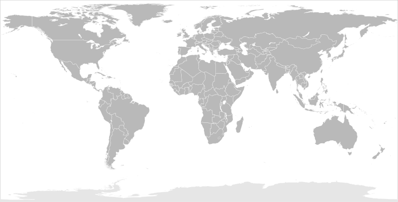
Fil:BlankMap-World-Flattened.svg

Storleken för denna PNG-förhandsvisning av denna SVG-fil: 800 × 406 pixlar. Andra upplösningar: 320 × 162 pixlar | 640 × 325 pixlar | 1 024 × 519 pixlar | 1 280 × 649 pixlar | 2 560 × 1 299 pixlar | 2 754 × 1 397 pixlar.
Originalfil (SVG-fil, standardstorlek: 2 754 × 1 397 pixlar, filstorlek: 1,68 Mbyte)
| Denna fil tillhandahålls av Wikimedia Commons. Informationen nedan är kopierad från dess filbeskrivningssida. |
Sammanfattning
| Beskrivning |
English: Blank political map of the world in modified (flattened) Robinson projection. This image is a sample of output from nugsl-worldmap, a Python script for the manipulation of this map. The script can also produce rotated images, add pinpoint marks at particular geographic coordinates, and produce web pages with clickable areas for specific countries and pinpoint marks.
Note that this map is not equirectangular, and cannot be used as a push-pin map to identify coordinates assuming equal latitude and longitude spacing. A map using the equirectangular projection is available at File:BlankMap-World6-Equirectangular.svg. |
| Datum | (for the script only) |
| Källa |
http://www.law.nagoya-u.ac.jp/en/appendix/software/worldmap/ Refactored from Image:BlankMap-World.svg, q.v. |
| Skapare | Frank Bennett |
| Tillstånd (Återanvändning av denna fil) |
The map data manipulated by the script is in the public domain. The raw output of the script, including the file shown here, is also in the public domain. |
| Andra versioner |
Filer som bygger på denna fil:
|
| SVG utveckling |
Licensiering
| Jag, upphovsrättsinnehavaren till detta verk, släpper detta verk i public domain. Detta gäller globalt. I vissa länder kan detta inte vara juridiskt möjligt; i så fall: Jag ger härmed envar rätten att använda detta verk för alla ändamål, utan några villkor, förutom villkor som lagen ställer. |
Filhistorik
Klicka på ett datum/klockslag för att se filen som den såg ut då.
| Datum/Tid | Miniatyrbild | Dimensioner | Användare | Kommentar | |
|---|---|---|---|---|---|
| nuvarande | 20 mars 2014 kl. 12.44 | | 2 754 × 1 397 (1,68 Mbyte) | Underlying lk | fix classes for Soudan and South Soudan |
| 16 mars 2013 kl. 18.01 |  | 2 754 × 1 397 (1,68 Mbyte) | Flappiefh | South Sudan added. | |
| 14 januari 2008 kl. 13.47 |  | 2 754 × 1 397 (1,67 Mbyte) | Biercenator | Updated to current version of map produced by the script. | |
| 19 december 2007 kl. 15.22 |  | 940 × 477 (1,99 Mbyte) | Biercenator | == Summary == Refactored from en:Image:BlankMap-World6.svg, q.v. This image is a sample of output from [http://gsl-nagoya-u.net/appendix/software/worldmap/ nugsl-worldmap], a Python script for the manipulation and maintenance of this map. The flatt | |
| 15 december 2007 kl. 17.31 |  | 940 × 477 (2 Mbyte) | Biercenator | Refactored from en:Image:BlankMap-World6.svg, q.v. This image might prove useful if you want to change the area shown in the center of the Robinson projection version, since the conversion can be reversed. | |
| 15 december 2007 kl. 17.18 |  | 940 × 477 (2 Mbyte) | Biercenator | == Summary == Refactored from en:BlankMap-World6.svg, q.v. This image might prove useful if you want to area shown in the center of the Robinson projection version, since the conversion can be reversed. |
Filanvändning
Inga sidor använder den här filen.
Global filanvändning
Följande andra wikier använder denna fil:
- Användande på ca.wikipedia.org
- Användande på de.wikipedia.org
- Användande på en.wikipedia.org
- Användande på es.wikipedia.org
- Användande på fr.wikipedia.org
- Användande på he.wikipedia.org