Fil:MSH80 mailboxes along cowlitz river 1980.jpg
Storlek på förhandsvisningen: 800 × 522 pixlar. Andra upplösningar: 320 × 209 pixlar | 640 × 418 pixlar | 1 024 × 668 pixlar | 1 280 × 835 pixlar | 2 919 × 1 905 pixlar.
Originalfil (2 919 × 1 905 pixlar, filstorlek: 1,78 Mbyte, MIME-typ: image/jpeg)
| Denna fil tillhandahålls av Wikimedia Commons. Informationen nedan är kopierad från dess filbeskrivningssida. |
Sammanfattning
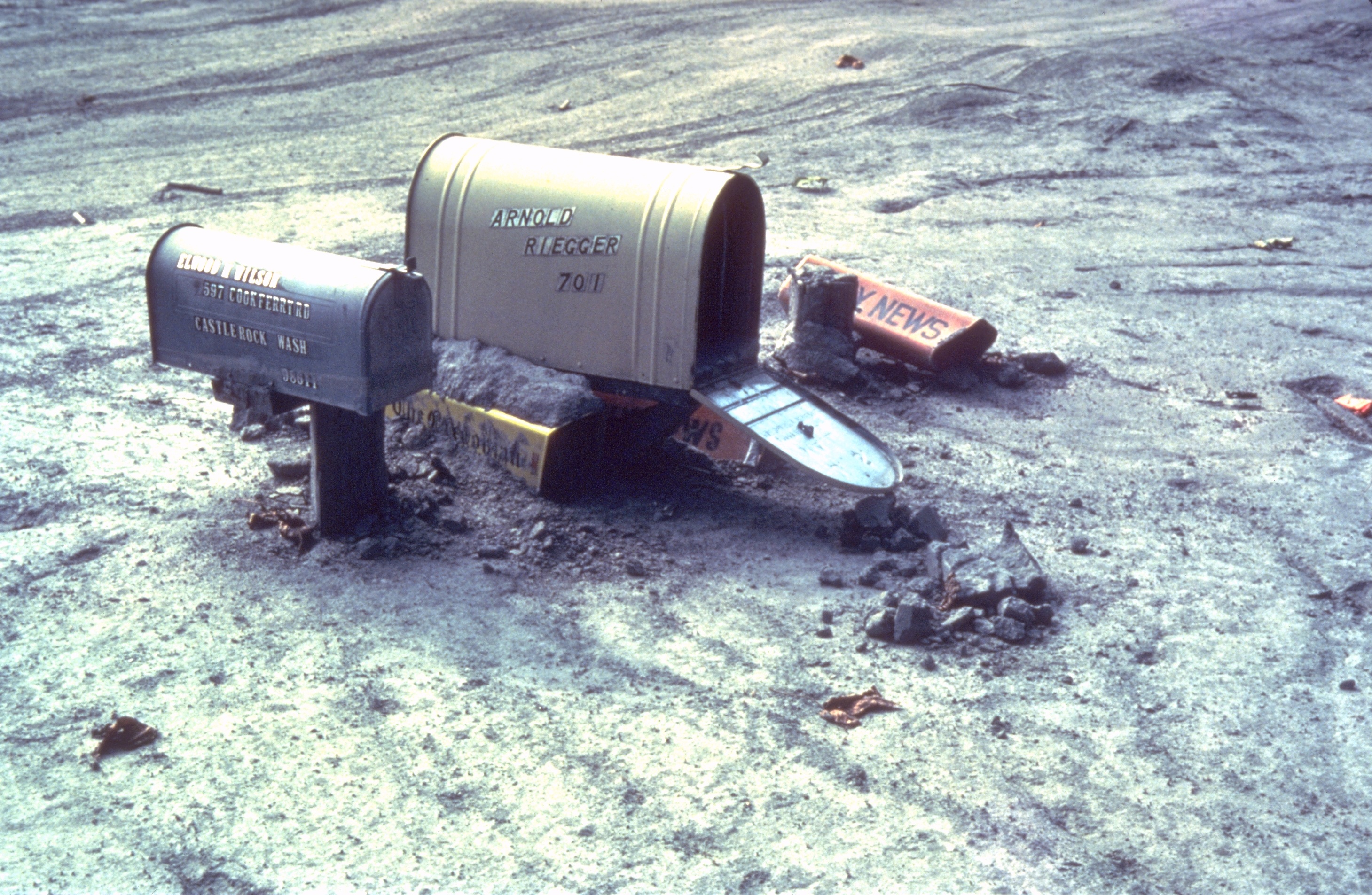
| Beskrivning | Mailboxes sticking out of a mudflow along the Cowlitz River in Castle Rock, Washington after the May 18, 1980 explosion of Mount St. Helens |
| Datum | sommaren 1980 |
| Källa | Archived source link |
| Skapare | Lyn Topinka, USGS |
| Kameraposition | | Se denna och andra närliggande bilder på: OpenStreetMap |
|---|
Licensiering
This image is in the public domain in the United States because it only contains materials that originally came from the United States Geological Survey, an agency of the United States Department of the Interior. For more information, see the official USGS copyright policy.
|
Filhistorik
Klicka på ett datum/klockslag för att se filen som den såg ut då.
| Datum/Tid | Miniatyrbild | Dimensioner | Användare | Kommentar | |
|---|---|---|---|---|---|
| nuvarande | 31 mars 2006 kl. 19.28 | | 2 919 × 1 905 (1,78 Mbyte) | Mnh | ==English== {{Information| |Description=Mailboxes in the mudflow along the Cowlitz River created by the May 18th, 1980 eruption of the Mount St. Helens. |Source=[http://vulcan.wr.usgs.gov/Volcanoes/MSH/Images/mudflow_images.html USGS Cascades Volcano Obse |
Filanvändning
Följande sida använder den här filen:
Global filanvändning
Följande andra wikier använder denna fil:
- Användande på ar.wikipedia.org
- Användande på de.wikipedia.org
- Användande på en.wikipedia.org
- Användande på eo.wikipedia.org
- Användande på es.wikipedia.org
- Användande på fr.wikipedia.org
- Användande på fy.wikipedia.org
- Användande på id.wikipedia.org
- Användande på ig.wikipedia.org
- Användande på ka.wikipedia.org
- Användande på ko.wikipedia.org
- Användande på la.wikipedia.org
- Användande på lt.wikipedia.org
- Användande på ms.wikipedia.org
- Användande på nl.wikipedia.org
- Användande på nn.wikipedia.org
- Användande på no.wikipedia.org
- Användande på pt.wikipedia.org
- Användande på simple.wikipedia.org
- Användande på uk.wikipedia.org
- Användande på zh-yue.wikipedia.org