Fil:SpainDueroBasin.png

Storlek på förhandsvisningen: 800 × 572 pixlar. Andra upplösningar: 320 × 229 pixlar | 640 × 457 pixlar | 1 024 × 732 pixlar | 1 280 × 915 pixlar | 1 748 × 1 249 pixlar.
Originalfil (1 748 × 1 249 pixlar, filstorlek: 2,55 Mbyte, MIME-typ: image/png)
| Denna fil tillhandahålls av Wikimedia Commons. Informationen nedan är kopierad från dess filbeskrivningssida. |
Sammanfattning
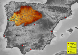
| Beskrivning | Map of Duero river basin in Spain, Karte des hydrogeografischen Beckens des Duero |
| Datum | |
| Källa | Own work, based on an image of http://www.maps-for-free.com/ (Creative Commons Attribution Share Alike 3.0) |
| Skapare | Port(u*o)s |
| Tillstånd (Återanvändning av denna fil) |
Creative Commons Attribution Share Alike 3.0 |
Licensiering
Denna fil har gjorts tillgänglig under licensen Creative Commons Erkännande-Dela Lika 3.0 Generisk
- Du är fri:
- att dela – att kopiera, distribuera och sända verket
- att remixa – att skapa bearbetningar
- På följande villkor:
- erkännande – Du måste ge lämpligt erkännande, ange en länk till licensen och indikera om ändringar har gjorts. Du får göra det på ett lämpligt sätt, men inte på ett sätt som antyder att licensgivaren stödjer dig eller din användning.
- dela lika – Om du remixar, transformerar eller bygger vidare på materialet måste du distribuera dina bidrag under samma eller en kompatibel licens som originalet.
Filhistorik
Klicka på ett datum/klockslag för att se filen som den såg ut då.
| Datum/Tid | Miniatyrbild | Dimensioner | Användare | Kommentar | |
|---|---|---|---|---|---|
| nuvarande | 7 oktober 2021 kl. 18.41 | | 1 748 × 1 249 (2,55 Mbyte) | Lojwe | Santiago mal posicionada |
| 5 februari 2019 kl. 03.51 |  | 1 748 × 1 249 (2,11 Mbyte) | TouchName | recorte de marco | |
| 30 oktober 2007 kl. 04.07 |  | 1 808 × 1 307 (2,57 Mbyte) | Port(u*o)s | == Summary == {{Information |Description=Map of Duero river basin in Spain, Karte des hydrogeografischen Beckens des Duero |Source= Own work, based on an image of http://www.maps-for-free.com/ (Creative Commons Attribution Share Alike 3.0) |Date=October 2 |
Filanvändning
Följande sida använder den här filen:
Global filanvändning
Följande andra wikier använder denna fil:
- Användande på af.wikipedia.org
- Användande på ast.wikipedia.org
- Användande på ca.wikipedia.org
- Användande på cs.wikipedia.org
- Användande på cv.wikipedia.org
- Användande på de.wikipedia.org
- Användande på el.wikipedia.org
- Användande på eo.wikipedia.org
- Användande på es.wikipedia.org
- Duero
- Río Carrión
- Pisuerga
- Eresma
- Adaja
- Río Arlanza
- Río Aliste
- Río Tera
- Río Zapardiel
- Río Guareña
- Río Huebra
- Río Jerga
- Úrbel
- Voltoya
- Río Duratón
- Río Margañán
- Anexo:Ríos de España
- Usuario discusión:NACLE
- Río Malo
- Cuenca hidrográfica del Duero
- Río Valdeginate
- Río Almar
- Río Grande (afluente del Carrión)
- Río Arevalillo
- Plantilla:Ficha de cuerpo de agua
- Plantilla:Ficha de cuerpo de agua/doc
- Río Negro (afluente del Omaña)
- Río Navajos
- Río Valdesamario
- Río Castro (afluente del Tera)
- Río Manzanas
- Río Tuela
- Río Gamoneda
- Río Truchas
- Río Cueza
Visa mer globalt användande av denna fil.