Fil:Port Phillip Bay.png
Det finns ingen version med högre upplösning.
Port_Phillip_Bay.png (768 × 523 pixlar, filstorlek: 897 kbyte, MIME-typ: image/png)
| Denna fil tillhandahålls av Wikimedia Commons. Informationen nedan är kopierad från dess filbeskrivningssida. |
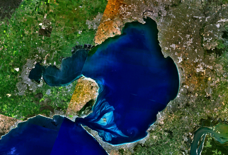
w:Port Phillip Bay, Australia. Melbourne is visible at the head of the bay, Geelong at the head of the western arm, Corio Bay.
| This image is in the public domain because it is a screenshot from NASA’s globe software World Wind using a public domain layer, such as Blue Marble, MODIS, Landsat, SRTM, USGS or GLOBE.
|
 |
Filhistorik
Klicka på ett datum/klockslag för att se filen som den såg ut då.
| Datum/Tid | Miniatyrbild | Dimensioner | Användare | Kommentar | |
|---|---|---|---|---|---|
| nuvarande | 28 december 2005 kl. 23.56 | | 768 × 523 (897 kbyte) | Stephen Bain | w:Port Phillip Bay, Australia. Melbourne is visible at the head of the bay, Geelong at the head of the western arm, Corio Bay. {{PD-WorldWind}} |
Filanvändning
Följande sida använder den här filen:
Global filanvändning
Följande andra wikier använder denna fil:
- Användande på ar.wikipedia.org
- Användande på be-tarask.wikipedia.org
- Användande på be.wikipedia.org
- Användande på ceb.wikipedia.org
- Användande på en.wikipedia.org
- Användande på en.wikivoyage.org
- Användande på es.wikipedia.org
- Användande på fi.wikipedia.org
- Användande på fr.wikipedia.org
- Användande på ga.wikipedia.org
- Användande på gl.wikipedia.org
- Användande på he.wikipedia.org
- Användande på he.wikivoyage.org
- Användande på it.wikipedia.org
- Användande på it.wiktionary.org
- Användande på ja.wikipedia.org
- Användande på lt.wikipedia.org
- Användande på pl.wikipedia.org
- Användande på pt.wikipedia.org
- Användande på ru.wikipedia.org
- Användande på simple.wikipedia.org
- Användande på uk.wikipedia.org
- Användande på www.wikidata.org