Fil:Old map of Vietnam.jpg

Originalfil (3 024 × 2 179 pixlar, filstorlek: 1,99 Mbyte, MIME-typ: image/jpeg)
| Denna fil tillhandahålls av Wikimedia Commons. Informationen nedan är kopierad från dess filbeskrivningssida. |
Sammanfattning
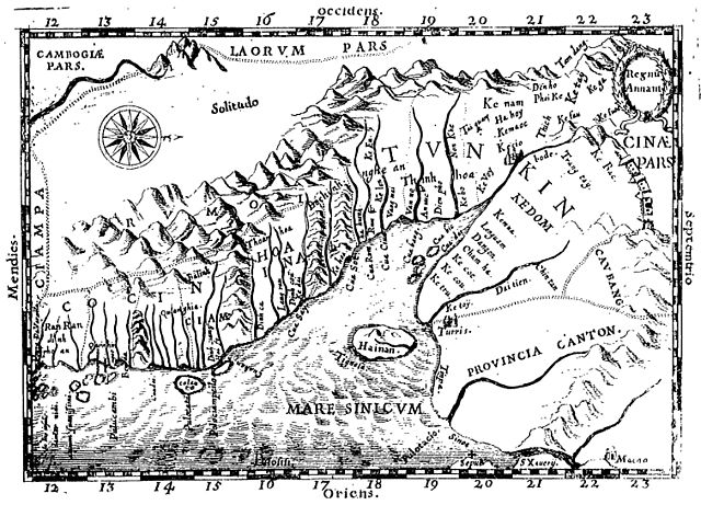
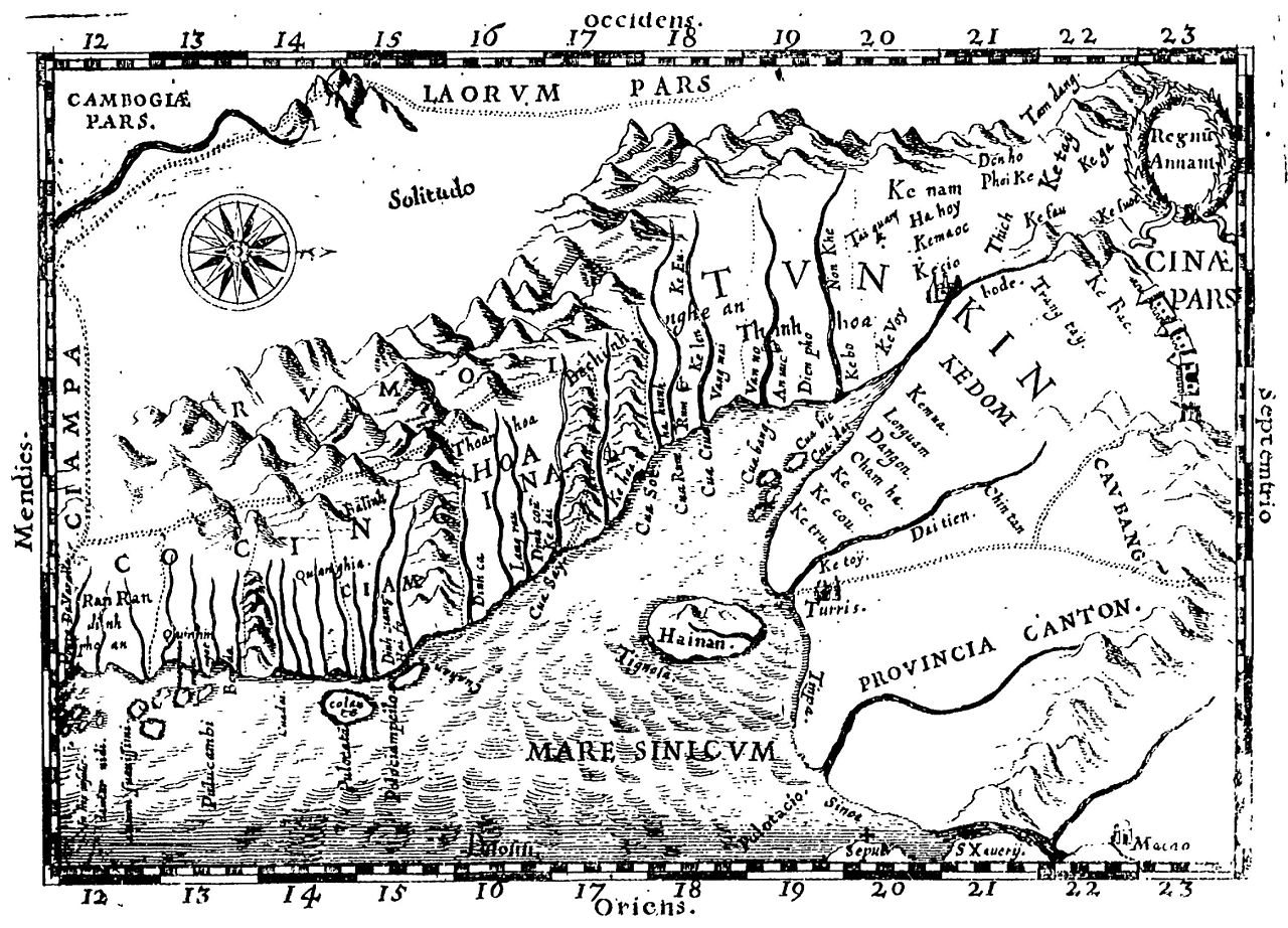
Early Western Map of Tonkin (1651). One of the earliest Western maps showing details of northern and central Vietnam appeared in Father Alexander de Rhodes's Histoire dv royavme de Tvnqvin, published in Rome in 1650. This map is from the French edition, published a year later in Lyon. Oriented with the north to the right, "Regnu Annam" shows the extent of seventeenth-century Vietnam, then divided between two rival dynasties, one in the north and the other in central Vietnam. Remnants of the Cham kingdom, eventually destroyed by the Vietnamese, still exist in the south. To the west, are the highlands occupied by "Rumoi" (upland minority groups, later called "montagnards" by the French). The limited Western knowledge of the interior is illustrated by the large region labeled "Solitudo."
(originally from https://www.loc.gov/rr/asian/guide/guide-southern.html) High-resolution version from The BNF
Licensiering
|
Detta verk är också upphovsrättsfritt i länder och områden där upphovsrätten förfaller 70 år eller färre efter upphovsmannens död.
| |
| Denna fil har identifierats som fri från kända begränsningar enligt upphovsrätten, inklusive alla relaterade och närliggande rättigheter. | |
Filhistorik
Klicka på ett datum/klockslag för att se filen som den såg ut då.
| Datum/Tid | Miniatyrbild | Dimensioner | Användare | Kommentar | |
|---|---|---|---|---|---|
| nuvarande | 20 april 2011 kl. 22.28 | | 3 024 × 2 179 (1,99 Mbyte) | Dragfyre | cropped to center the map image |
| 22 maj 2009 kl. 13.52 |  | 3 298 × 2 581 (1,4 Mbyte) | DHN | updating high-res version | |
| 9 september 2006 kl. 14.39 |  | 640 × 473 (105 kbyte) | DHN | Early Western Map of Tonkin (1651). One of the earliest Western maps showing details of northern and central Vietnam appeared in Father Alexander de Rhodes's Histoire dv royavme de Tvnqvin, published in Rome in 1650. This map is from the French edition, |
Filanvändning
Följande sida använder den här filen:
Global filanvändning
Följande andra wikier använder denna fil:
- Användande på ast.wikipedia.org
- Användande på azb.wikipedia.org
- Användande på az.wikipedia.org
- Användande på bn.wikipedia.org
- Användande på br.wikipedia.org
- Användande på ca.wikipedia.org
- Användande på ceb.wikipedia.org
- Användande på da.wikipedia.org
- Användande på de.wikipedia.org
- Användande på en.wikipedia.org
- Användande på en.wiktionary.org
- Användande på eo.wikipedia.org
- Användande på es.wikipedia.org
- Användande på fr.wikipedia.org
- Användande på gl.wikipedia.org
- Användande på id.wikipedia.org
- Användande på it.wikipedia.org
- Användande på ja.wikipedia.org
- Användande på km.wikipedia.org
- Användande på ms.wikipedia.org
- Användande på no.wikipedia.org
- Användande på pl.wikipedia.org
- Användande på pt.wikipedia.org
- Användande på sl.wikipedia.org
- Användande på vi.wikipedia.org