Fil:New Caledonia - S199828000484.jpg

Originalfil (734 × 870 pixlar, filstorlek: 180 kbyte, MIME-typ: image/jpeg)
| Denna fil tillhandahålls av Wikimedia Commons. Informationen nedan är kopierad från dess filbeskrivningssida. |
Sammanfattning
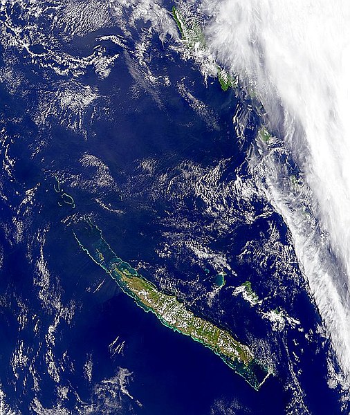
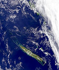
SeaWiFS captured this view of New Caledonia with neighboring Vanuatu hidden just beneath the clouds to the northeast.
Source: [1]
Meta-data: Sensor: OrbView-2/SeaWiFS Datastart: 1998-10-07 Visible Earth: v1 ID 5203 Visualization Date: 1998-10-07
Credit: the SeaWiFS Project, NASA/Goddard Space Flight Center, and ORBIMAGE
Licensiering
| This image is from the Sea-viewing Wide Field-of-view Sensor (SeaWiFS) Project and more than 5 years old.
Satellite data captured by the SeaWIFS sensor are released into the public domain 5 years after capture. Data less than five years old can be re-used only for educational or scientific purposes; any commercial use of such images must be coordinated with GeoEye. [2] |
| This work has been released into the public domain by its copyright holder, GeoEye. This applies worldwide. I vissa länder kan detta inte vara juridiskt möjligt; i så fall: GeoEye ger envar rätten att använda detta verk för alla ändamål, utan några villkor, förutom villkor som lagen ställer.
|
Filhistorik
Klicka på ett datum/klockslag för att se filen som den såg ut då.
| Datum/Tid | Miniatyrbild | Dimensioner | Användare | Kommentar | |
|---|---|---|---|---|---|
| nuvarande | 21 november 2005 kl. 15.00 | | 734 × 870 (180 kbyte) | Avenue | SeaWiFS captured this view of New Caledonia with neighboring Vanuatu hidden just beneath the clouds to the northeast. Source: [http://visibleearth.nasa.gov/view_rec.php?id=1325] Meta-data: Sensor: OrbView-2/SeaWiFS Datastart: 1998-10-07 Visib |
Filanvändning
Följande sida använder den här filen:
Global filanvändning
Följande andra wikier använder denna fil:
- Användande på af.wikipedia.org
- Användande på ba.wikipedia.org
- Användande på co.wikipedia.org
- Användande på el.wikipedia.org
- Användande på en.wikipedia.org
- Användande på fa.wikipedia.org
- Användande på fr.wikipedia.org
- Användande på gl.wikipedia.org
- Användande på hr.wikipedia.org
- Användande på id.wikipedia.org
- Användande på it.wikipedia.org
- Användande på it.wikivoyage.org
- Användande på ja.wikipedia.org
- Användande på pl.wikipedia.org
- Användande på pt.wikipedia.org
- Användande på ru.wikipedia.org
- Användande på sh.wikipedia.org
- Användande på sk.wikipedia.org
- Användande på sr.wikipedia.org
- Användande på uk.wikipedia.org
- Användande på vi.wikipedia.org
- Användande på zh.wikipedia.org