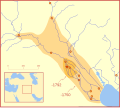
Fil:Hammurabi's Babylonia Locator Map 1.svg

Storleken för denna PNG-förhandsvisning av denna SVG-fil: 671 × 600 pixlar. Andra upplösningar: 269 × 240 pixlar | 537 × 480 pixlar | 859 × 768 pixlar | 1 146 × 1 024 pixlar | 2 291 × 2 048 pixlar | 744 × 665 pixlar.
Originalfil (SVG-fil, standardstorlek: 744 × 665 pixlar, filstorlek: 154 kbyte)
Filhistorik
Klicka på ett datum/klockslag för att se filen som den såg ut då.
| Datum/Tid | Miniatyrbild | Dimensioner | Användare | Kommentar | |
|---|---|---|---|---|---|
| nuvarande | 21 februari 2008 kl. 05.26 |  | 744 × 665 (154 kbyte) | MapMaster | "blurred" the territory outlines |
| 21 februari 2008 kl. 01.22 |  | 744 × 665 (149 kbyte) | MapMaster | Changes based on a review of ''Mesopotamia and the Bible'' | |
| 21 februari 2008 kl. 00.10 |  | 744 × 665 (151 kbyte) | MapMaster | Minor edits | |
| 19 februari 2008 kl. 05.03 |  | 744 × 665 (150 kbyte) | MapMaster | Once more, with feeling | |
| 19 februari 2008 kl. 04.09 |  | 744 × 665 (151 kbyte) | MapMaster | earlier upload would not render | |
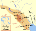
| 19 februari 2008 kl. 04.01 |  | 332 × 292 (333 kbyte) | MapMaster | {{Information |Description=A locator map of Hammurabi's Babylonia, showing the Babylonian territory upon his ascension in 1792 BC and upon his death in 1750 BC. The river courses and coastline are those of that time period -- in general, they are not the |
Filanvändning
Följande 2 sidor använder den här filen:
Global filanvändning
Följande andra wikier använder denna fil:
- Användande på bg.wikipedia.org
- Användande på bs.wikipedia.org
- Användande på cs.wikipedia.org
- Användande på da.wikipedia.org
- Användande på el.wikipedia.org
- Användande på eo.wikipedia.org
- Användande på et.wikipedia.org
- Användande på fi.wikipedia.org
- Användande på fr.wikipedia.org
- Användande på gl.wikipedia.org
- Användande på he.wikipedia.org
- Användande på hr.wikipedia.org
- Användande på hu.wikipedia.org
- Användande på id.wikipedia.org
- Användande på it.wikipedia.org
- Användande på ja.wikipedia.org
- Användande på jv.wikipedia.org
- Användande på lt.wikipedia.org
- Användande på lv.wikipedia.org
- Användande på nl.wikipedia.org
- Användande på no.wikipedia.org
- Användande på pl.wikipedia.org
- Användande på pt.wikipedia.org
- Användande på ro.wikipedia.org
- Användande på ru.wikipedia.org
- Användande på sh.wikipedia.org
- Användande på sl.wikipedia.org
- Användande på sq.wikipedia.org
- Användande på sw.wikipedia.org
- Användande på tr.wikipedia.org


