Fil:CQA Four Mile Bridge.jpg
Storlek på förhandsvisningen: 753 × 600 pixlar. Andra upplösningar: 301 × 240 pixlar | 603 × 480 pixlar | 964 × 768 pixlar | 1 280 × 1 020 pixlar | 2 560 × 2 039 pixlar | 4 624 × 3 683 pixlar.
Originalfil (4 624 × 3 683 pixlar, filstorlek: 1,88 Mbyte, MIME-typ: image/jpeg)
| Denna fil tillhandahålls av Wikimedia Commons. Informationen nedan är kopierad från dess filbeskrivningssida. |
|
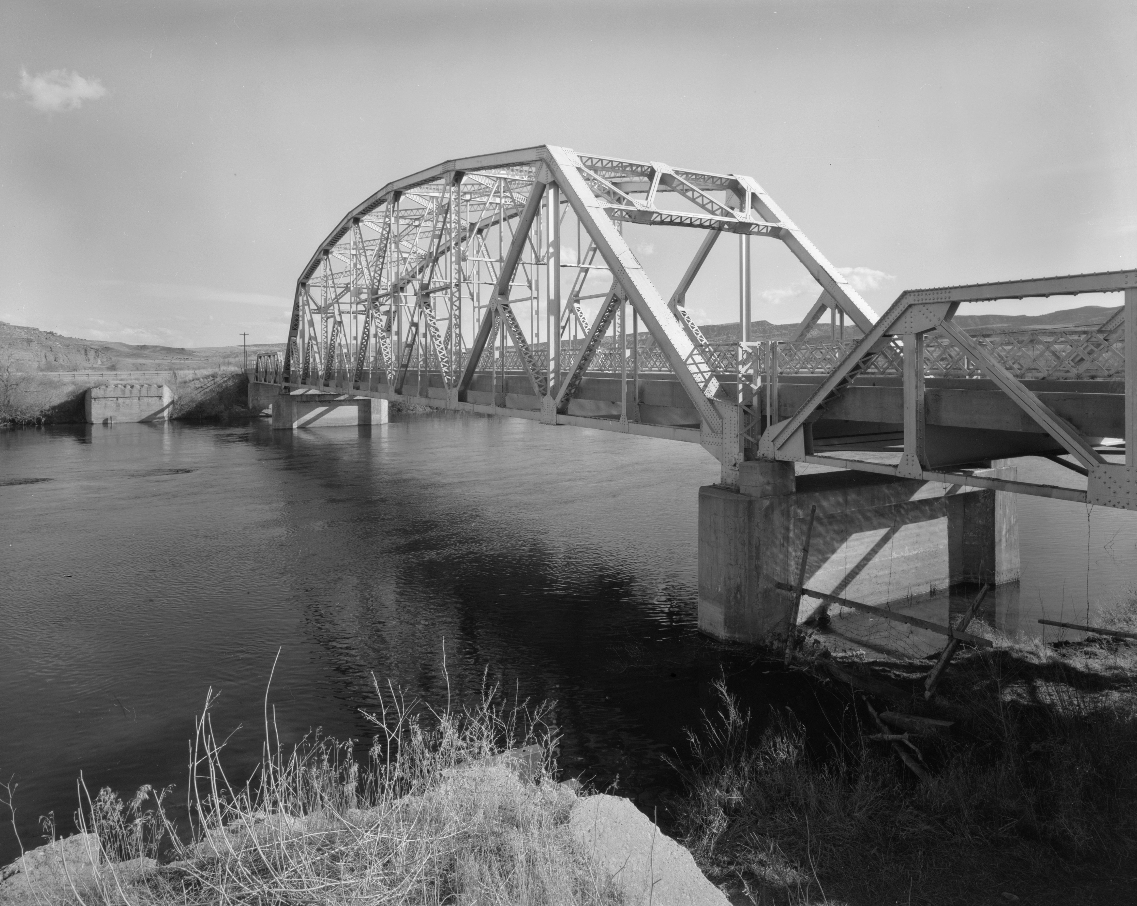
This is an image of a place or building that is listed on the National Register of Historic Places in the United States of America. Its reference number is 85000423. |
| Kameraposition | | Se denna och andra närliggande bilder på: OpenStreetMap |
|---|
| Beskrivning |
English: Eastern side of the CQA Four Mile Bridge, which carries WYO 173 over the Bighorn River near Thermopolis in Hot Springs County, Wyoming, United States. Built in 1927, this Pennsylvania through truss bridge is listed on the National Register of Historic Places. |
||||
| Datum | |||||
| Källa |
Library of Congress, Prints and Photograph Division HAER: WYO,9-THERM.V,2-1
|
||||
| Skapare | Clayton B. Fraser | ||||
| Tillstånd (Återanvändning av denna fil) |
|

Filhistorik
Klicka på ett datum/klockslag för att se filen som den såg ut då.
| Datum/Tid | Miniatyrbild | Dimensioner | Användare | Kommentar | |
|---|---|---|---|---|---|
| nuvarande | 27 april 2009 kl. 18.14 | | 4 624 × 3 683 (1,88 Mbyte) | Martin H. | high res; cropped |
| 25 april 2009 kl. 17.18 |  | 1 024 × 820 (170 kbyte) | Nyttend | {{Location|43|36|13|N|108|11|48|W}} {{Information |Description={{en|Eastern side of the {{w|CQA Four Mile Bridge}}, which carries {{w|Wyoming Highway 173|WYO 173}} over the {{w|Bighorn River}} near {{w|Thermopolis, Wyoming|Thermopolis}} in {{w|Hot Springs |
Filanvändning
Följande sida använder den här filen:
Global filanvändning
Följande andra wikier använder denna fil:
- Användande på arz.wikipedia.org
- Användande på ca.wikipedia.org
- Användande på ceb.wikipedia.org
- Användande på da.wikipedia.org
- Användande på de.wikipedia.org
- Användande på en.wikipedia.org
- Användande på no.wikipedia.org
- Användande på www.wikidata.org
- Användande på xmf.wikipedia.org