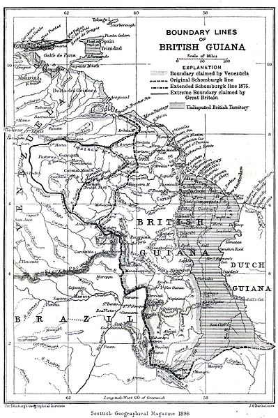
Fil:Boundary lines of British Guiana 1896.jpg

Storlek på förhandsvisningen: 399 × 599 pixlar. Andra upplösningar: 160 × 240 pixlar | 320 × 480 pixlar | 925 × 1 388 pixlar.
Originalfil (925 × 1 388 pixlar, filstorlek: 372 kbyte, MIME-typ: image/jpeg)
Filhistorik
Klicka på ett datum/klockslag för att se filen som den såg ut då.
| Datum/Tid | Miniatyrbild | Dimensioner | Användare | Kommentar | |
|---|---|---|---|---|---|
| nuvarande | 28 februari 2006 kl. 21.38 |  | 925 × 1 388 (372 kbyte) | Julo | Boundary lines of British Guiana on the map of ''Scottisch Geographical Magazine'', 1896 (page 88) {{PD-old}} Category:Maps of Guyana |
Filanvändning
Följande 3 sidor använder den här filen:
Global filanvändning
Följande andra wikier använder denna fil:
- Användande på als.wikipedia.org
- Användande på an.wikipedia.org
- Användande på ar.wikipedia.org
- Användande på ast.wikipedia.org
- Användande på be.wikipedia.org
- Användande på bn.wikipedia.org
- Användande på ca.wikipedia.org
- Användande på da.wikipedia.org
- Användande på de.wikipedia.org
- Användande på de.wikisource.org
- Användande på el.wikipedia.org
- Användande på en.wikipedia.org
- Användande på eo.wikipedia.org
- Användande på es.wikipedia.org
- Användande på et.wikipedia.org
- Användande på eu.wikipedia.org
- Användande på fa.wikipedia.org
- Användande på fi.wikipedia.org
- Användande på fr.wikipedia.org
- Användande på gl.wikipedia.org
- Användande på he.wikipedia.org
- Användande på hi.wikipedia.org
- Användande på hr.wikipedia.org
- Användande på id.wikipedia.org
Visa mer globalt användande av denna fil.