Fil:Tetiaroa.jpg
Originalfil (617 × 668 pixlar, filstorlek: 111 kbyte, MIME-typ: image/jpeg)
| Denna fil tillhandahålls av Wikimedia Commons. Informationen nedan är kopierad från dess filbeskrivningssida. |
Sammanfattning
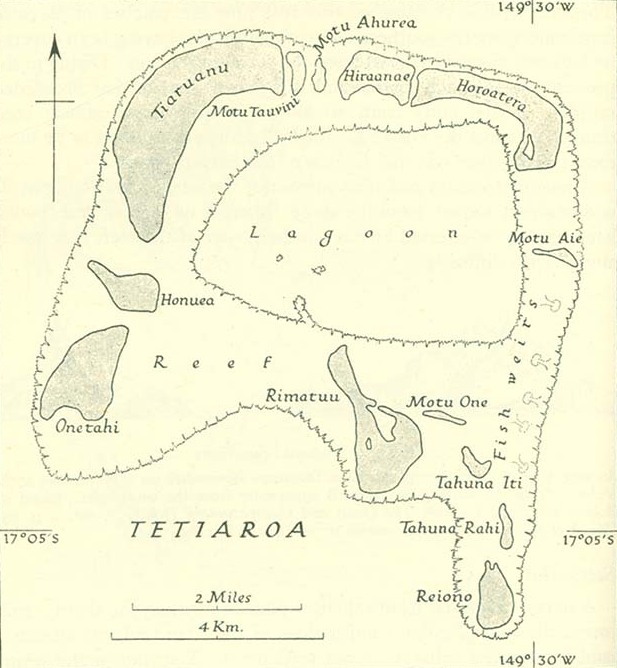
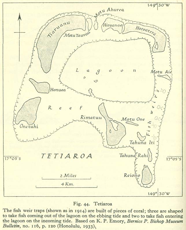
http://www.lib.utexas.edu/maps/historical/pacific_islands_1943_1945/tetiaroa.jpg
Public domain, as explained on page http://www.lib.utexas.edu/usage_statement.html?maps=yes: "Most of the maps scanned by the University of Texas Libraries and served from this web site are in the public domain. No permissions are needed to copy them. You may download them and use them as you wish. A few maps are copyrighted, and are clearly marked as such."
The motu of Tahuna Iti and the sandbank of Motu One are interchanged on the map.
Licensiering
Denna fil är i public domain, för att it has been taken from a collection of public domain maps at the University of Texas Library''
Om detta inte anses möjligt av rättsliga orsaker: Var vänlig och kontrollera att den angivna anledningen är giltig.
|
Filhistorik
Klicka på ett datum/klockslag för att se filen som den såg ut då.
| Datum/Tid | Miniatyrbild | Dimensioner | Användare | Kommentar | |
|---|---|---|---|---|---|
| nuvarande | 18 januari 2014 kl. 10.00 | | 617 × 668 (111 kbyte) | Cropbot | upload cropped version, operated by User:Andy king50. Summary: cropped |
| 21 oktober 2006 kl. 17.23 |  | 644 × 797 (92 kbyte) | Ratzer | http://www.lib.utexas.edu/maps/historical/pacific_islands_1943_1945/tetiaroa.jpg Public domain, as explained on page http://www.lib.utexas.edu/usage_statement.html?maps=yes: "Most of the maps scanned by the University of Texas Libraries and served from t |
Filanvändning
Följande sida använder den här filen:
Global filanvändning
Följande andra wikier använder denna fil:
- Användande på als.wikipedia.org
- Användande på az.wikipedia.org
- Användande på ca.wikipedia.org
- Användande på de.wikipedia.org
- Användande på en.wikipedia.org
- Användande på eo.wikipedia.org
- Användande på es.wikipedia.org
- Användande på fr.wikipedia.org
- Användande på gl.wikipedia.org
- Användande på hu.wikipedia.org
- Användande på mk.wikipedia.org
- Användande på no.wikipedia.org
- Användande på pl.wikipedia.org
- Användande på pt.wikipedia.org
- Användande på ru.wikipedia.org
- Användande på zh.wikipedia.org