Fil:Sandusky Ohio aerial view.jpg
Storlek på förhandsvisningen: 800 × 533 pixlar. Andra upplösningar: 320 × 213 pixlar | 640 × 426 pixlar | 1 024 × 682 pixlar | 1 500 × 999 pixlar.
Originalfil (1 500 × 999 pixlar, filstorlek: 761 kbyte, MIME-typ: image/jpeg)
| Denna fil tillhandahålls av Wikimedia Commons. Informationen nedan är kopierad från dess filbeskrivningssida. |
| Beskrivning |
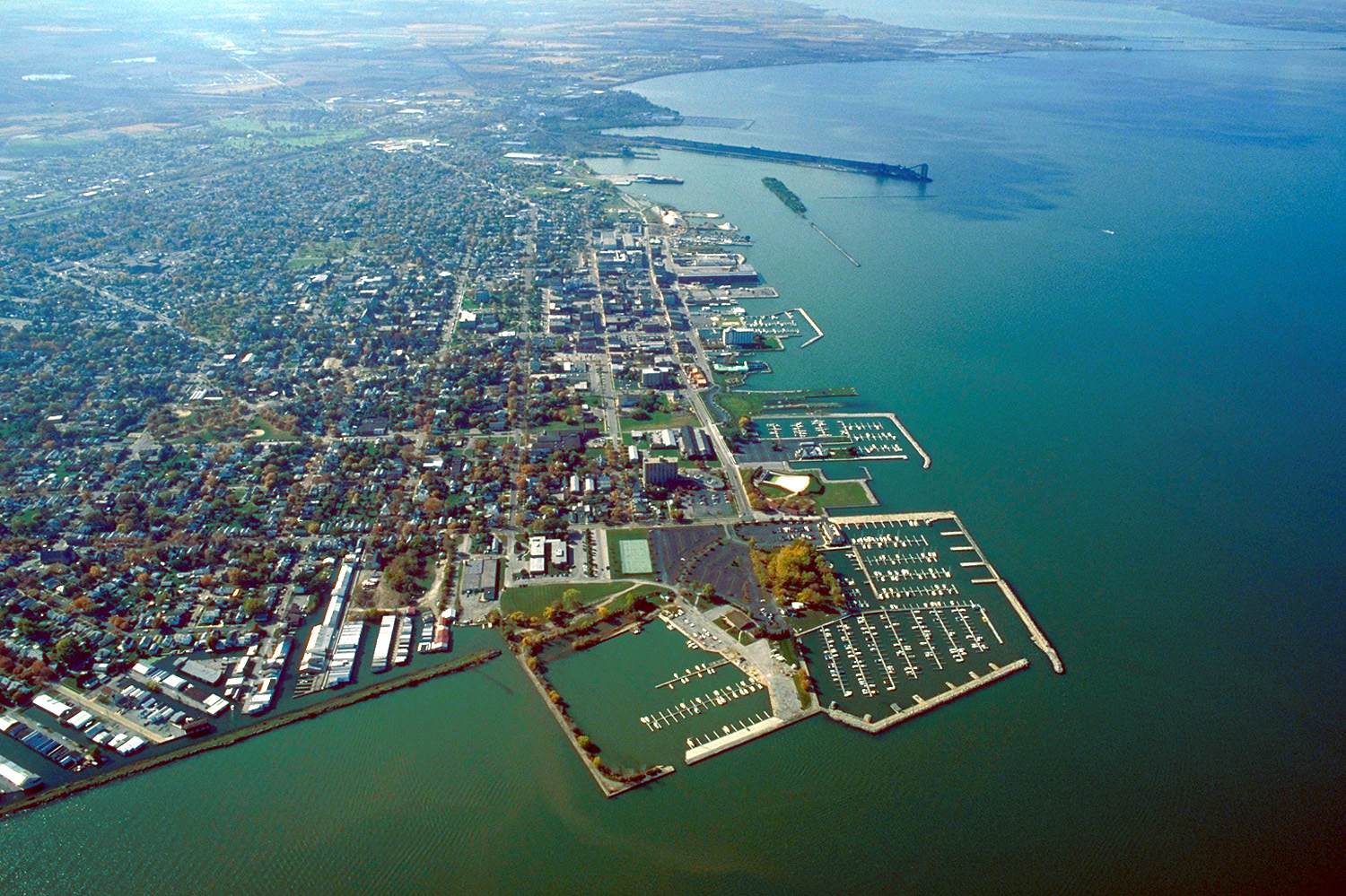
English: Aerial view of Sandusky, Ohio, USA. The view is to the west-southwest along the waterfront on Sandusky Bay, a large inlet and bay off of Lake Erie. |
|||
| Datum | ||||
| Källa |
U.S. Army Corps of Engineers Digital Visual Library Image page Image description page Digital Visual Library home page |
|||
| Skapare | Ken Winters, U.S. Army Corps of Engineers | |||
| Tillstånd (Återanvändning av denna fil) |
|
|||
| Plats | Sandusky, Ohio, USA |
| Kameraposition | | Se denna och andra närliggande bilder på: OpenStreetMap |
|---|
Filhistorik
Klicka på ett datum/klockslag för att se filen som den såg ut då.
| Datum/Tid | Miniatyrbild | Dimensioner | Användare | Kommentar | |
|---|---|---|---|---|---|
| nuvarande | 24 mars 2007 kl. 23.44 | | 1 500 × 999 (761 kbyte) | DanMS | {{Information | Description = {{en|Aerial view of Sandusky, Ohio, USA. The view is to the west-southwest along the waterfront on Sandusky Bay, a large inlet and bay off of Lake Erie.}} | Source = U.S. Army Corps of Engineers Digital Visual Libr |
Filanvändning
Följande sida använder den här filen:
Global filanvändning
Följande andra wikier använder denna fil:
- Användande på azb.wikipedia.org
- Användande på ceb.wikipedia.org
- Användande på de.wikipedia.org
- Användande på en.wikinews.org
- Användande på es.wikipedia.org
- Användande på fa.wikipedia.org
- Användande på fi.wikipedia.org
- Användande på fr.wikipedia.org
- Användande på it.wikipedia.org
- Användande på ko.wikipedia.org
- Användande på pl.wikipedia.org
- Användande på pt.wikipedia.org
- Användande på ru.wikipedia.org
- Användande på sh.wikipedia.org
- Användande på simple.wikipedia.org
- Användande på sr.wikipedia.org
- Användande på szl.wikipedia.org
- Användande på tr.wikipedia.org
- Användande på uk.wikipedia.org
- Användande på uz.wikipedia.org
- Användande på zh-min-nan.wikipedia.org
- Användande på zh.wikipedia.org