Fil:Arctic Ocean location map.svg

Storleken för denna PNG-förhandsvisning av denna SVG-fil: 600 × 599 pixlar. Andra upplösningar: 240 × 240 pixlar | 481 × 480 pixlar | 769 × 768 pixlar | 1 025 × 1 024 pixlar | 2 051 × 2 048 pixlar | 709 × 708 pixlar.
Originalfil (SVG-fil, standardstorlek: 709 × 708 pixlar, filstorlek: 589 kbyte)
| Denna fil tillhandahålls av Wikimedia Commons. Informationen nedan är kopierad från dess filbeskrivningssida. |
Sammanfattning
| Beskrivning |
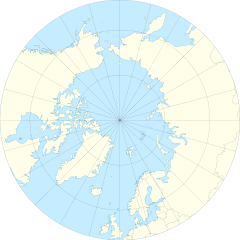
English: Location Map of the Arctic Ocean
|
| Datum | |
| Källa | Eget arbete |
| Skapare | Tentotwo |
| Andra versioner |
|

Licensiering
Jag, upphovsrättsinnehavaren av detta verk, publicerar härmed det under följande licens:
Denna fil har gjorts tillgänglig under licensen Creative Commons Erkännande-Dela Lika 3.0 Generisk
- Du är fri:
- att dela – att kopiera, distribuera och sända verket
- att remixa – att skapa bearbetningar
- På följande villkor:
- erkännande – Du måste ge lämpligt erkännande, ange en länk till licensen och indikera om ändringar har gjorts. Du får göra det på ett lämpligt sätt, men inte på ett sätt som antyder att licensgivaren stödjer dig eller din användning.
- dela lika – Om du remixar, transformerar eller bygger vidare på materialet måste du distribuera dina bidrag under samma eller en kompatibel licens som originalet.
Shell script for generating the map using GMT archive copy at the Wayback Machine
#!/bin/sh

# Set common options
PROJECTION=E0.0/90.0/20.0c
REGION=-180/180/50/90
FILENAME=arctic_ocean.ps

# Get Natural Earth datafiles
echo "Downloading datafiles from naturalearthdata.com"
wget -nv -nc \
 http://www.naturalearthdata.com/http//www.naturalearthdata.com/download/50m/physical/50m-coastline.zip\
 http://www.naturalearthdata.com/http//www.naturalearthdata.com/download/50m/physical/50m-land.zip\
 http://www.naturalearthdata.com/http//www.naturalearthdata.com/download/50m/cultural/50m-admin-0-boundary-lines.zip
echo "...done\n"

echo "Inflating archives"
unzip 50m\*.zip
echo "...done\n"

echo "Converting shapefiles to GMT"
ogr2ogr -F GMT 50m_land.gmt 50m_land.shp
ogr2ogr -F GMT 50m_coastline.gmt 50m_coastline.shp
ogr2ogr -F GMT 50m_borders.gmt ne_50m_admin_0_boundary_lines_land.shp
echo "...done\n"

echo "Creating maps"
GMT psxy -m -J$PROJECTION -R$REGION -Bg15 --POLAR_CAP=none --BASEMAP_TYPE=plain --BASEMAP_AXES=WeS 50m_land.gmt -K -G254/254/233 > $FILENAME
GMT psxy -m -J$PROJECTION -R$REGION 50m_coastline.gmt -O -K -W9/120/171  >> $FILENAME
GMT psxy -m -J$PROJECTION -R$REGION 50m_borders.gmt -O -W100/100/100  >> $FILENAME
echo "...done\n"

echo "You can now open $FILENAME in Inkscape to clean up the file and save it as SVG. You should add an ocean coloured background and simplify the graticules using CTRL+L."
Filhistorik
Klicka på ett datum/klockslag för att se filen som den såg ut då.
| Datum/Tid | Miniatyrbild | Dimensioner | Användare | Kommentar | |
|---|---|---|---|---|---|
| nuvarande | 27 januari 2012 kl. 13.54 | | 709 × 708 (589 kbyte) | Tentotwo |
Filanvändning
Följande 2 sidor använder den här filen:
Global filanvändning
Följande andra wikier använder denna fil:
- Användande på af.wikipedia.org
- Användande på ar.wikipedia.org
- Användande på ast.wikipedia.org
- Polu Norte
- Islla de la Soledá
- Adventfjorden
- Isfjorden
- Estrechu de Davis
- Aeropuertu de Jan Mayen
- Aeropuertu de Svalbard
- Módulu:Mapa de llocalización/datos/Árticu/usu
- Módulu:Mapa de llocalización/datos/Árticu
- Kvitøya
- Kükenthaløya
- Nordaustlandet
- Wilhelmøya
- Austfonna
- Storøya
- Estrechu d'Hinlopen
- Ny-Friesland
- Sorgfjorden
- Verlegenhuken
- Wahlbergøya
- Advent City
- Pyramiden
- Hiorthhamn
- Isfjord Radio
- Användande på az.wikipedia.org
- Användande på ban.wikipedia.org
- Användande på bcl.wikipedia.org
- Användande på ceb.wikipedia.org
- Användande på ce.wikipedia.org
- Användande på cs.wikipedia.org
- Användande på de.wikipedia.org
Visa mer globalt användande av denna fil.